Arctic Winter Ships Ice Breakers Ocean Ice Water
Project Acronym: AIS PAC – AIS for Prioritizing Arctic Charting
Project Duration: July 1, 2017 – December 31, 2018
Project Sponsorship: Arctic Domain Awareness Center, Anchorage, AK
The information in this site reflects investigations and conclusions sponsored by the Arctic Domain Awareness Center, (ADAC) a U.S. Department of Homeland Security (DHS) Center of Excellence in Maritime Research, hosted by the University of Alaska. Associated activities were supported by DHS under Grant Award Number 2014-ST-061-ML0002. The views and conclusions of the information presented in this site reflects research conducted via ADAC and should not be interpreted as necessarily representing the official policies, either expressed or implied, of the U.S. Department of Homeland Security.
Background
The U.S. Arctic is experiencing significant changes widely recognized by both Alaska coastal communities and regulatory agencies across the region, including the U.S. Coast Guard. September 2016 experienced the fifth lowest sea ice extent and the third lowest sea ice volume on record for the month of September (2012 is the lowest), and the spring of 2018 experienced the lowest sea ice extent off Western Alaska coasts in more than 150 years of record-keeping. Sea ice coverage has decreased to the point that existing northern shipping lanes around the world are open for longer periods of time and are projected to experience a continued increase in marine vessel traffic (Arctic Council, 2009). In recognizing a large area of historically ice covered Arctic waters has recently evolved into a new maritime frontier, it is important the routes where deep draft vessels are starting to sail are surveyed to modern day standards. A marine casualty in the Arctic, which extends from the southern Bering Sea all the way into international waters of the Arctic Ocean, has few infrastructural support resources, presents far greater risk of loss of life or environmental harm than marine casualties in most other maritime regions, where there are more response resources, less harsh weather conditions and more resilient and less pristine environments.
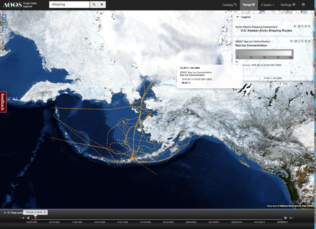
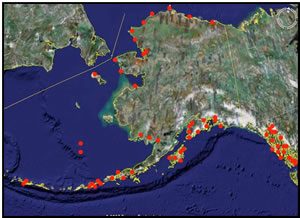
Image from the AOOS Ocean Data Explorer data portal of the National Sea Ice Data Center sea ice concentration in June 1979, near the start of the satellite ice records. Superimposed on this plot is the U.S. Alaskan Arctic Shipping Routes.
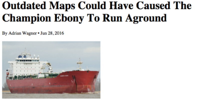
Recent incidents in the U.S. Arctic highlight these threats, such as the grounding of the tanker CHAMPION EBONY in the summer of 2016 near Alaska’s Nunivak Island. This grounding occurred in an area where navigational charts were reporting outdated bathymetry that falsely reflected adequate water depth for safe passage. Such events demonstrate the importance of identifying areas where vessels are currently operating with respect to the areas lacking sufficient navigational information, in particular updated and dependable bathymetry.
Project Motivation
The Arctic Domain Awareness Center’s Arctic-related Incidents of National Significance (Arctic IoNS) workshop in June 2016 highlighted the need to improve awareness and understanding of nearshore bathymetry across the Arctic and in particular, the North American Arctic. This project – AIS PAC (AIS for Prioritizing Arctic Charting is designed to address that need and provide access to critical data related to vessel tracking and bathymetry.
Automated Information System (AIS)
Since 2004, larger commercial vessels engaged in international trade have been required to be equipped with transponders that transmit information about the vessel several times a minute to other vessels and to shore-based Automated Information Systems (AIS) receiving stations within range. The information provided by these transponders is transmitted several times a minute and includes, but is not limited to, the name and type of vessel, dimensions, including the length, draft, beam and gross tonnage, course, speed and other information. This tracking technology has provided historical records of vessels’ transits to assist NOAA and the Coast Guard in identifying where vessels are currently navigating in specific areas, and this information used to establish safe, accurately surveyed corridors in an effort to minimize vessel groundings and the associated maritime safety and environmental impacts.
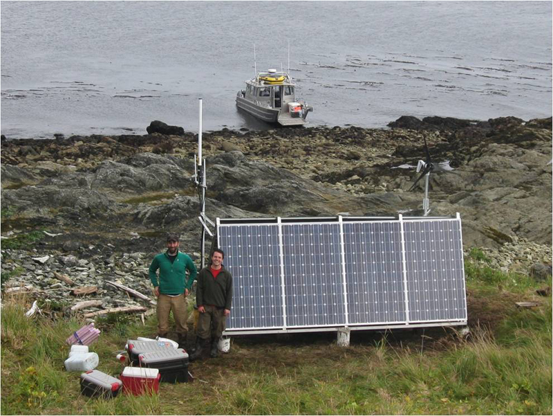
The Marine Exchange of Alaska working on a solar and wind powered remote AIS installation in Alaska.
Approach
This is a collaborative effort between the Alaska Ocean Observing System (AOOS), the Marine Exchange of Alaska and Axiom Data Science (Axiom). The team will directly support the NOAA Office of Coast Survey (NOAA OCS) to create products that inform decision-making about vessel traffic and safety in a rapidly changing Arctic environment.
During this project, we are developing the capability to significantly reduce the execution time for handling and analyzing extremely large collections of AIS vessel tracking data. This capability will enable the investigating team to produce a variety of AIS-derived data products that can be utilized by the NOAA OCS Hydrographic Health Model to identify vessel safety risk areas, such as those with outdated bathymetry or insufficient coastal detail for safe passage of vessel traffic. Data products that are of interest to other stakeholders working in the region will also be developed, such as being able to display ship transit patterns with sensitive environmental information or oil spill trajectories.
Using and optimizing a high capacity, parallel compute workflow solves the current data volume processing challenges experienced by NOAA OCS by streamlining the workflow. Valuable summaries of vessel density patterns from massive quantities of data across multiple vessel types, environments, and locations are the goal, including the ability to visualize the information interactively with other maritime data using the AOOS Data Portal system.
The team has previous project experience including recent NOAA OCS investments, in particular the Integrated Ocean Observing System (IOOS)-funded special project, NOAA OCS: AIS Big Data Project. Long-term, this same parallelization workflow approach used on the “big AIS data” problem can effortlessly be generalizable to other coastal areas, thereby benefiting a broader audience of maritime industries and federal agencies nationwide.
For more on the AIS data and the data handling approach, and to see other AIS Data sets we are using these methods with, please visit our AIS projects and supporters weblink: AIS Vessel Traffic Data Products
The Data
The Marine Exchange of Alaska (MXAK) currently operates 48 terrestrial AIS stations in the Arctic, receiving over 3 million messages per day.
One year’s data has over 2 million lines of information, with each line containing 20 pieces of data that we need sort through, such as ship size, draft, and class. Errors in these data need to be corrected first, as sometimes ships do not transmit the correct information about their vessel due to information entry errors to the transmitter prior to sailing. The MXAK accomplishes this by performing data cross checks using international maritime data bases they have access to. The AIS PAC Project will ultimately compile, validate and correct, several billion lines of AIS data transmitted by vessels operating in U.S. Arctic waters, data obtained and stored by the MXAK AIS Network over the previous five years to present. This continuous record will help identify recent changes in shipping activity across the region.
Expected Data Products
The primary data product will be a consistently formatted synthesized and quality controlled AIS dataset, that can then be directly utilized by NOAA to help prioritize where modern hydrographic surveys need to occur for this rapidly changing region. The data product and affiliated web tools for visualizing the data will benefit other entities interested in shipping trends in the Arctic.
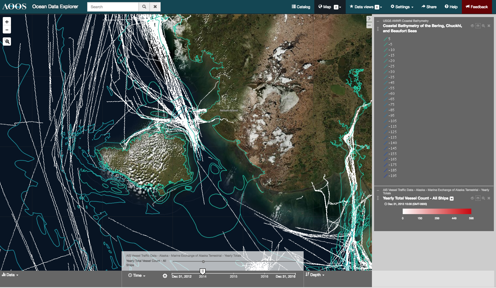
 Image from the AOOS Ocean Data Explorer AIS PAC Portal showing the USGS coastal bathymetry from the Bering, Chukchi and Beaufort Seas plotted with the yearly total vessel counts in 2013 (upper panel) and again in 2016 (lower panel).
All project data products are available for public use through this dedicated interactive project data portal/website (See Data Portal Entry link on the menu bar on this webpage).
 Image from the Ocean Data Explorer AIS PAC Portal showing Yearly total vessel counts for all ships from 2012 (upper panel) and again in 2016 (lower panel) plotted with the Beluga and Bowhead Whale Spring Migration Corridors (Synthesis of Important Areas in the U.S. Chukchi Sea)
Data Sets already served by AOOS and included in the AIS PAC Portal:
AIS DATA Fields
AIS Vessel Traffic Data – Alaska- MXAK AK Terrest. – Monthly Totals
AIS Vessel Traffic Data – Alaska – MXAK AK Terrest. – Yearly Totals
Marine Habitats and Sensitive Biological areas
Audubon Important Bird areas
Pacific Walrus Coastal Haul-out DB 1852-2016
Walrus areas of use
Synthesis of Important Areas in the U.S. Chukchi Sea
Arctic Marine Synthesis
Synthesis of Important Areas in the U.S. Beaufort Sea
NMFS Critical Habitat Areas
USFWS Seabird Studies
Community level socioeconomic and subsistence information
BSSN data
ISER Arctic Villages Socioeconomic Data
BOEM COMIDA
NEW NAS DATA for harvester heat maps and oil spill trajectories????
Shipping and Transportation
Arctic Marine Shipping Assessment
Arctic Maritime & Aviation Transportation Infrastructure
Commercial and State Resource information
BOEM/BSEE Oil and Gas
DNR Oil and Gas Resources
Governmental boundaries
Alaska Governmental Boundaries
Maritime Limits and Boundaries
Marine Protected Areas in the Canadian Beaufort
Bathymetry information
Alaska Region Digital Elevation Model
Aleutian Island Bathymetry
Coastal Bathymetry from the Bering, Chukchi and Beaufort Seas (USGS ANWR Bathymetry)
International Bathymetric Chart of the Arctic
Norton Sound Bathymetry
Weather
Old weather forecasts from 2012-2017
Ocean
CORDC AK Coastal HF Radar Derived surface currents
GHRSST Level 4 MUR SSTs
Sea Ice information
National Weather Service Alaska Sea Ice Program
NSIDC Sea Ice Concentration
SNAP Sea Ice Atlas

