2019 Field Season Photos from Foggy Island Bay
Drone docked and ready, sitting next to the Foggy Island Bay Met station in 2019.
Jeremy Kasper (right) and Stephanie deploying moorings in Foggy Island Bay 2019.
New Wind Sensor weather vane for FIB MET Station. Looks like a whale!
Seabat Echosounder (Left) and bottom mounted mooring configuration with ADCP and CTD on spider mooring (Right).
2018 Field Season Photos from Foggy Island Bay
Research Vessels Used for Ocean Going Activities

16m vessel well-suited for work in the region and is equipped with an articulating A-frame with a 2,000 lb. capacity winch with 450 meters of cable and a 6” deck mounted capstan winch. The UAF multibeam transducer was mounted to the port-side gunwale of the Ukpik

The M/V Leeway is a 11m x 4m Catamaran used during the September 24th -26th 2018 cruises, to retrieve moorings and to access the shore-based met-station. Captain Heather Ronek operated the Leeway for the duration of the cruise.
Meteorological (weather) site photos, Foggy Island Bay – These data are streaming real-time on the project data portal.
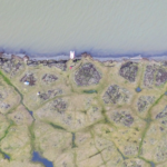
- Aerial shot of met station location in Foggy Island Bay taken during 3D sampling.
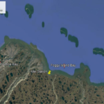
- Map showing the location of the 2018 met station. Lat 70.204075N, Lon 147.701386W
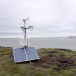
- Photograph of the 2018 full suite met station in Foggy Island Bay, with solar panels for recharging batteries.
Field Deployments


