NOAA IOOS Program Office
Visit the Integrated Ocean Observing System Website
IOOS is designed to enhance our ability to collect, deliver, and use ocean information. The goal is to provide continuous data on our open oceans, coastal waters, and Great Lakes in the formats, rates, and scales required by scientists, managers, businesses, governments, and the public to support research and inform decision-making.
In 2007, NOAA established a new program to coordinate NOAA’s IOOS activities. The mission of the Program Office is to “lead the integration of ocean, coastal, and Great Lakes observing capabilities, in collaboration with Federal and non-Federal partners, to maximize access to data and generation of information products, inform decision making, and promote economic, environmental, and social benefits to our nation and the world.”
In 2008, The NOAA IOOS program initiated development of a Data Integration Framework (DIF) to improve management and delivery of ocean observations. The DIF will establish the technical infrastructure, standards, and protocols needed to improve delivery of IOOS core oceanographic variables defined in the U.S. IOOS Development Plan.
NOAA will complete initial development of the DIF in 2010, providing seven IOOS variables from multiple observing system data sources in consistent formats expected to achieve improvements in a select set of NOAA’s decision-support tools.
National Federation of Regional Associations
The coastal component is required to assess and predict the effects of weather, climate and human activities on the state of the coastal ocean, on its ecosystems and living resources, and on the nation’s economy. It encompasses the nation’s Exclusive Economic Zone (EEZ), the Great Lakes, and estuaries and consists of a national backbone of observations of the EEZ and a set of nested regional observing systems.
More information on the national backbone and regional observing systems is available from the National Federation of Regional Associations.
Regional Planning Document describes contributions to ocean observing
As the uses of our coastal and Great Lakes waters increase and become more diverse, and as we face the unknown consequences of a changing climate, so the need for accurate and timely information intensifies.
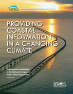
Providing Coastal Information in a Changing Climate (left) describes the contributions being made to the national program by AOOS and the other ten regional systems. It also includes plans for budgeting for observing capacity, product services, system management, and outreach.
Download the Regional Planning Document (PDF)
Global Ocean Observing System
The global ocean component is an international collaboration to develop a global observing system. The Global Ocean Observing System is designed to improve forecasts and assessments of weather, climate, ocean states, and boundary conditions for regional observing systems. It is anticipated to be part of the Global Earth Observing System of Systems, or GEOSS (Interagency Working Group on Earth Observations and Group on Earth Observations).
Arctic Observing Network
Visit the AON Website and Data Portal
The AON is envisioned as a system of atmospheric, land- and ocean-based environmental monitoring capabilities — from ocean buoys to satellites — that will significantly advance our observations of Arctic environmental conditions. Data from the AON will enable the interagency U.S. government initiative — the Study of Environmental Arctic Change (SEARCH) — to get a handle on the wide-ranging series of significant and rapid changes occurring in the Arctic.
Recent environmental changes in the Arctic are both large and rapid. The AON will allow scientists to:
- record the full suite of changes
- understand the causes and consequences of the changes underway
- predict the course, magnitude and consequences of future changes
- develop adaptive responses to future change.
Sustaining Arctic Observing Network
Sustaining Arctic Observing Networks (SAON) is a process to support and strengthen the development of multinational engagement for sustained and coordinated pan-Arctic observing and data sharing systems that serve societal needs, particularly related to environmental, social, economic and cultural issues.
The SAON Vision is that users should have access to free, open and high quality data that will realize pan-Arctic and global value-added services and provide societal benefits. To attain that vision, SAON’s goal is to enhance Arctic-wide observing activities by facilitating partnerships and synergies among existing ‘building blocks’, and promoting sharing and synthesis of data and information.
To achieve that goal, SAON is a resource for a broad community that includes governments and operational agencies, scientific researchers, indigenous peoples and northern residents, other stakeholders and the public.
Ocean.US
Ocean.US was the national program office established to coordinate the development of the IOOS. The IOOS is being developed in two closely related components that encompass the broad range of scales required to assess, detect and predict the effects of global climate change, the weather and human activities. This office closed in 2008; see the official announcement. The Ocean.us website is being maintained; it has publications, reports and information about past workshops.


