
Below you will find brief descriptions of AOOS interactive maps and data discovery tools. To download complete data sets, scroll down to the bottom on this page for a table of interoperable web services.
Ocean Data Explorer — This statewide portal provides access to all of AOOS’ public data, allowing users to visualize and integrate different types of data from many sources. Search or browse real-time conditions, operational and research forecasts, satellite observations, and other spatially referenced datasets that describe the biological, chemical and physical characteristics of Alaska and its surrounding waters. You can add and remove layers, select base maps, and see change over time with an interactive time slider. You can also access metadata and project contacts, as well as download data in a variety of formats.
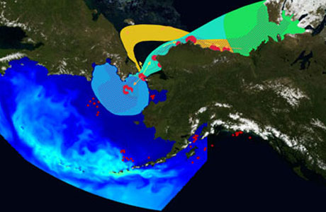
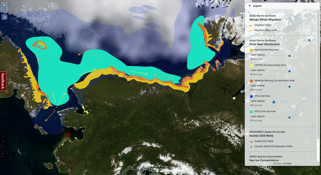 Arctic Portal — This portal is a subset of the Ocean Data Explorer that focuses on the northern Bering, Chukchi and Beaufort Seas. It integrates several hundred layers ranging from habitat type, climatic regimes, tagged animal locations, current weather conditions, political and ecological boundaries, and research instruments. A data layer catalog enables users to browse data and metadata by category or keyword. The development of this portal was supported by the STAMP project.
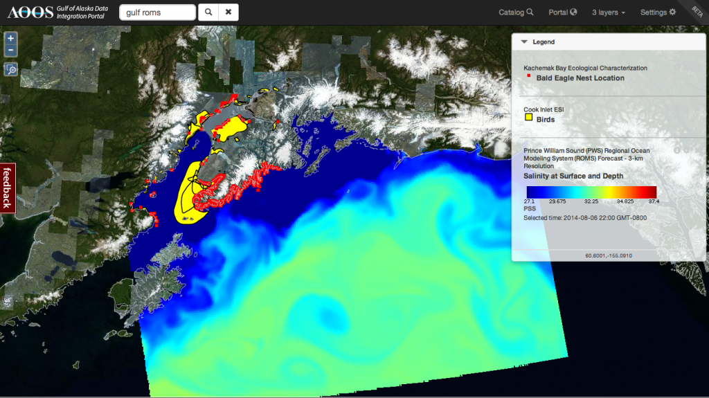 Gulf of Alaska Portal – This portal is a subset of the Ocean Data Explorer that focuses on the Gulf of Alaska. The search catalog provides access to several hundred data layers, some of which were developed through the long term monitoring programs of the Exxon Valdez Oil Spill Trustee Council’s Gulf Watch Alaska and Herring Research and Monitoring, as well as historical data from past EVOSTC projects. The portal is supported in partnership with the Gulf Watch Alaska Program.
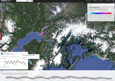
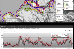
Real-time Sensor Map –This interactive map taps into more than 3,000 real-time sensors owned and maintained by a variety of federal, state and private entities. It is the only single access point for real-time data through Alaska for both marine and terrestrial stations.
Find the latest conditions including temperature, wind, wave height and precipitation. Click a point on the map to access primary source data and metadata, or to view more detailed information and images via webcam. You can also access historic data by loading an additional “historic sensors” layer to the view.
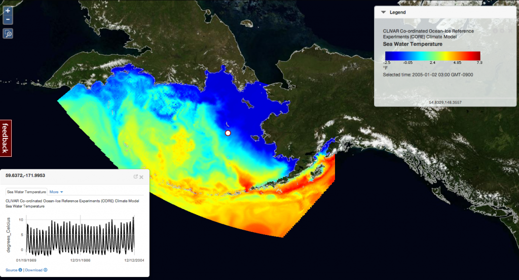
Model Explorer — This application displays gridded data sets including satellite observations, model predictions and input layers for numerical simulations. The data are provided by an array of research institutions and agencies across Alaska and elsewhere.
Users can browse data sets by category or keyword, search through metadata, jump backwards and forwards through time steps and explore different geographies. You can also drop a “virtual sensor” to extract a time series at specific location. Data is available for download in formats such as Excel and NETcdf.

Research Assets — Interested in the location of research instruments and monitoring efforts planned or deployed in Alaska’s waters? The Research Assets Map is a visual inventory of marine and coastal monitoring instruments and efforts in time. The map can be queried by time period, what is being measured, or who owns the instrument. While an effort is made to include all assets in the water each season, there may be components missing, or ones whose actual locations are different from those planned prior to deployment, and coverage prior to 2010 is limited. The focus has been on the Arctic but we will be expanding this tool statewide.
Cook Inlet Response Tool — Similar to the Arctic Portal, this data visualization tool incorporates multiple types of data (real-time sensors, model output, GIS layers, etc.) on a single screen. The tool was developed in collaboration with the Cook Inlet Regional Citizens Advisory Council to assist emergency responders in the event of an oil spill or other event. Unique to this tool is the ability to view video imagery and still photos for the entire coastline, drawing from the ShoreZone project. This allows users to virtually “fly the coast”, and integrate that information visually and spatially with other types of data.
The sea ice atlas uses a different interface than AOOS’ other tools
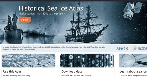
Historic Sea Ice Atlas – This atlas provides digitized historical sea ice data compiled from over ten different sources including the satellite record (1979-present), various US Naval and National Ice Center compilations (1950s to 1990s), Canadian records (1950s to 1980s), Danish and Norwegian ship records (mid-1800s to 1970s), and whaling ship reports (1850-1900). The interactive map allows users to select particular dates and locations, animating how open water seasons have varied in time and space. The tool can return specific data requests in both graphic and map formats. Additionally, the Atlas offers a glossary that defines different types of sea ice and provides information about the original data sources and how the data were compiled. The atlas is updated twice a year with current information. Partners on this project include the Alaska Center for Climate Assessment and Policy (ACCAP), the Scenarios Network for Alaska and Arctic Planning (SNAP), and AOOS.
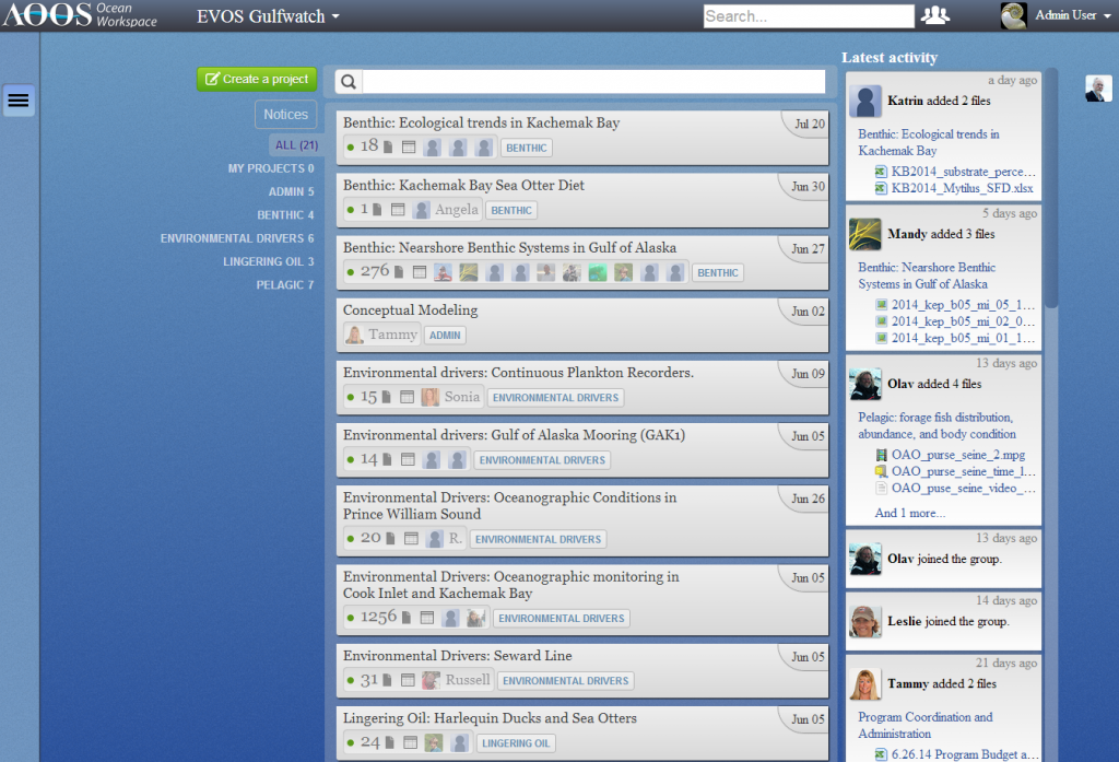 AOOS Research Workspace — The Workspace is a web-based data management solution for assembling, storing, and sharing data between members of the biological and physical oceanography research communities. The Workspace offers users an intuitive interface that allows users to create projects, which are analogous to scientific studies or specific directions of effort. Within each project, users may create topical groupings of data using folders and upload data and descriptive literature to their project by simply dragging and dropping files from their desktop into their web-browser.
Industry Arctic Data — Signed in August of 2011, a data-sharing agreement between NOAA and three oil companies (Shell, ConocoPhillips, and StatOil) is now providing the scientific community access to a wealth of data collected between 2008 and 2012 in the Chukchi Sea.
The agreement calls for sharing three major data sets in the lease sale areas: real-time weather and ocean observations, environmental information and sea ice and sea floor mapping data. During the open water season, real-time data is available through the AOOS Sensor Map. Historic weather, oceanographic and environmental studies data is freely available through the Research Workspace.

Seabird Portal — This map, funded by the US Fish & Wildlife Service, displays seabird colonies throughout the North Pacific coasts. However, it is a work in progress. Many of the colony data have errors and will be fixed in the next few months. Diet data is being revised and is not currently available.
Axiom Consulting is not responsible for the accuracy of the data, but feedback on the tool is appreciated.
Interoperable web services (for technical users)
Click Here for instructions on how to export datasets hosted through AOOS web-portals.
| Data Type | Service | Provider | Browsable URL1 | API URL2 |
|---|---|---|---|---|
| Vector | WMS | GeoServer | https://solo.axiomalaska.com/geoserver | http://wms.axiomalaska.com |
| Vector | WFS | GeoServer | https://solo.axiomalaska.com/geoserver | http://wfs.axiomalaska.com |
| Sensor | SOS | 52 North | http://sos.legacyaoos2.wpengine.com | |
| Gridded | OPeNDAP | Thredds | http://thredds.legacyaoos2.wpengine.com | |
| Gridded | WCS | Thredds | http://thredds.legacyaoos2.wpengine.com | |
| Gridded | netCDF Download | Thredds | http://thredds.legacyaoos2.wpengine.com | |
| Gridded | WMS | ncWMS | https://ncwms.axds.co/ | http://data.axds.co/ncWMS/ |
| Sensor | ERDDAP | NOAA | http://erddap.legacyaoos2.wpengine.com | |
1. Use the browsable URL when exploring datasets through the browser
2. For improved performance, use the API URL for applications.