

Click to enlarge
Access Industry Data
- Anyone can access the data
- Use will be tracked
- To create a user profile on the Research Workspace, contact Chris Turner at chris@axiomalaska.com
Signed in August of 2011, a data-sharing agreement between NOAA and three oil companies (Shell, ConocoPhillips, and StatOil) laid the groundwork for AOOS to provide public access to a wealth of oceanographic and environmental data. Available data includes Chukchi Sea environmental data between 2008 – 2012, and research logistics data (study area boundaries, station locations) from 2013. You can read more about the program here: chukchiscience.com/science.
The agreement calls for sharing several major data sets in the lease sale areas including: real-time weather and ocean observations, environmental information and sea ice and sea floor mapping data. During the open water season, real-time data is available through the AOOS Sensor Map. Historic weather, oceanographic and environmental studies data is freely available through the AOOS Research Workspace. To gain access to these datasets contact Chris Turner at chris@axiomalaska.com.
What kind of data was collected?
Details on the industry-collected data are available in annexes to the original agreement:
Annex 2: Environmental Studies Data
Annex 3: Hydrographic Data (annex under development)
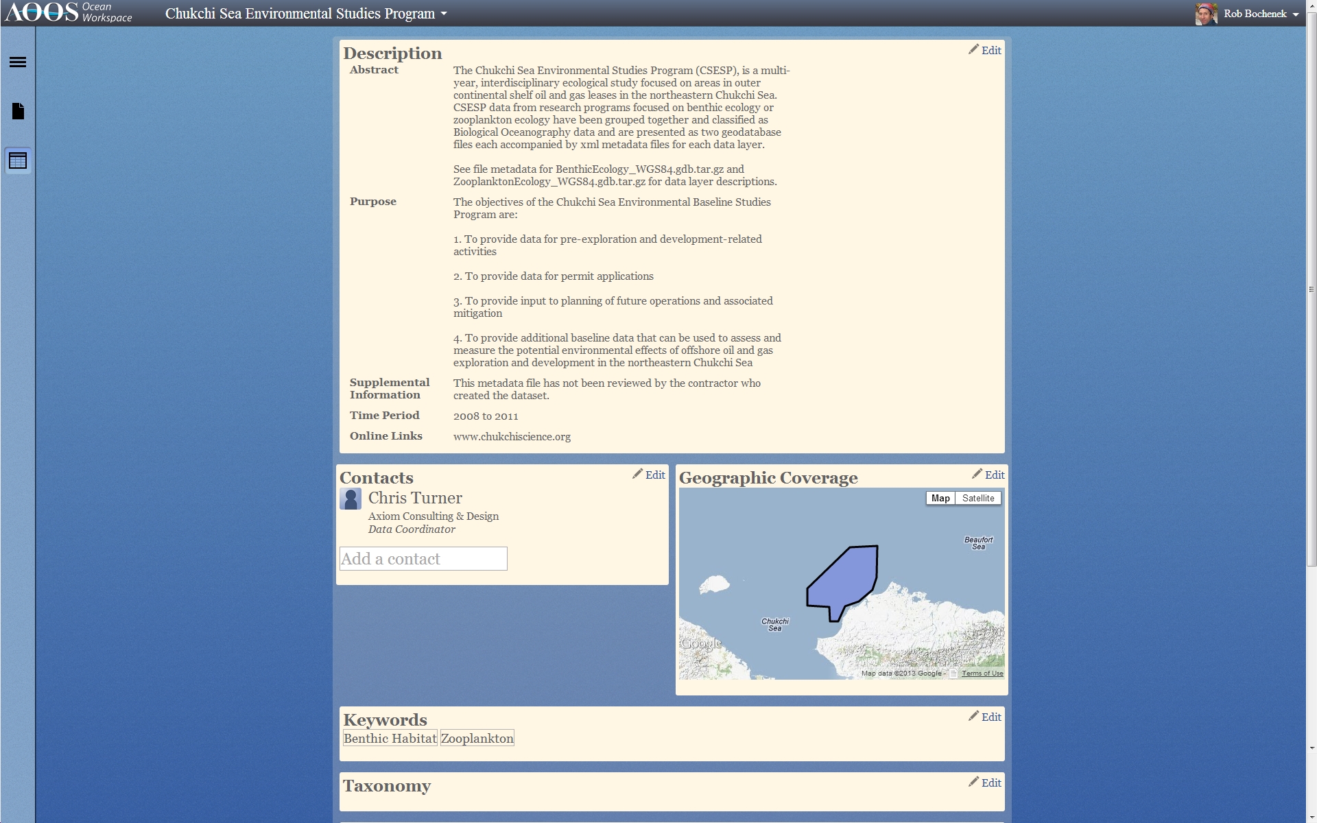
The Data in Annex 2 was collected through the Chukchi Sea Environmental Studies Program (CSESP), a multi-year, interdisciplinary ecological study focused on areas in outer continental shelf oil and gas leases in the northern Chukchi Sea. An overview of the study’s design, lead researchers and dicipline-specific information is available at: www.chukchiscience.org
What Industry-Funded Observing Assets are in the Water, and Where?
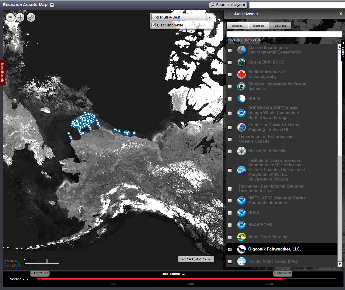 Assets include buoys, research cruises, acoustic recorders, and radars. Real-time data from industry metocean buoys stream live through the AOOS Sensor Map during the open water season and are archived at NODC. A screen capture of the Research Assets Map showing the industry-supported monitoring efforts is shown at right.
All About the Data Sharing Agreement
“Despite the wealth of scientific research conducted on the Arctic environment to date, much remains unknown, and no single government agency or entity has the resources or capacity to meet the task alone,” Jane Lubchenco, former NOAA administrator and undersecretary of commerce for oceans and atmosphere, stated when the umbrella agreement was signed in 2011. “This innovative partnership will significantly expand NOAA’s access to important data, enhance our understanding of the region and improve the United States’ ability to manage critical environmental issues efficiently and effectively as climate change continues to impact the Arctic.” Under the NOAA/Industry Data Sharing Agreement, NOAA conducts quality control on all industry data before it is incorporated into NOAA products and services.
The information now publicly available through AOOS is raw data from the industry studies and monitoring activities pictured above. This collaborative approach delivers many benefits, some of which are listed below.
NOAA Benefits: High-quality data enhances NOAA’s ability to understand and monitor changes in climate, weather, and physical and biological ocean processes. Increased observations help validate and improve forecast models.
Industry Benefits: By making raw data transparent, industry builds confidence in their research. Data sharing builds a positive relationship between industry and management.
Researchers and Science Communities Benefits: It is estimated that the Environmental Studies data collection and quality control alone represents a $75 million research investment. Through the AOOS website, scientists can now access three years of multiple sets of biological, chemical and physical data collected in the lease sale areas.
Public Benefits: Better understanding of the lease areas could increase response capacity in case of an environmental disaster, such as hazardous spill. Mariners and coastal residents benefit from improved weather and sea ice forecasts.