
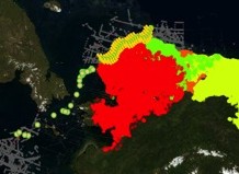
Click to enlarge
The AOOS Arctic Portal provides access to a broad variety of data layers, ranging from sea ice forecasts to species distribution, to human infrastructure and social & economic data.
AOOS and partners received funding from NOAA to develop data visualization tools for Alaska’s Arctic. The collection and synthesis of spatial data into a suite of visualization tools is a critical step for long-term collaborative planning in Alaska for a wide range of coastal uses. This project was called STAMP, and helped develop the AOOS Arctic Portal which is now live on the AOOS website and available to the public.
- Goal: Develop data integration & visualization tools that could be used for future decision-making relating to potential commercial fisheries in the Arctic.
- Area of focus: Northern Bering and Chukchi Seas
- Timeline: Jan 2012-June 2015
- Funding: NOAA’s Regional Ocean Partnership Program

- Links
STAMP produced 5 deliverables:
- An assessment of data and information products and tools needed for planning for future Arctic commercial fisheries, and identification of data layers that currently do not exist in Alaska. Read the scoping report.
- Identification of synergies with existing planning efforts for data and tools
- Documentation of existing data products and tools used in Alaska, and an assessment of new products and tools and their potential applicability to Alaska. Read the tools report.
- Incorporation of existing data layers into the AOOS Arctic Ocean Portal. View the portal.
- Assessment of the AOOS Arctic Portal (enhanced with datasets identified and synthesized through this project) for use in planning and decision-support for Arctic commercial fisheries.
Comments or suggestions? Email Darcy Dugan