Greetings Arctic researchers,
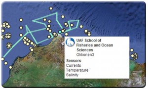
We are currently populating the Arctic Research Assets map with information from you. Many of you are already familiar with this interactive online map after participating last year. The 2010 map can be viewed here. The map displays research instrumentation and transects in the Beaufort and Chukchi in order to:
- Assist with research logistics
- Reduce duplication of effort
- Avoid collisions between vessels and deployed instruments
- Improve public education and outreach
- Support collaborations between scientists and projects
In order for the map to be an effective tool, we need each of you to provide information on the locations of your instruments and monitoring efforts. Below is a link to a web form that will walk you through what you need to do. Every few days, our system will be refreshed and the new assets will be displayed.
Access the Web Form
You can upload the information on your assets at any time. If you know the *proposed* locations of your instruments or transects right now, please add them. We can help you change the locations or other metadata if your plans change later.
If you have any questions about the form, please email Darcy Dugan. We're excited about the 2011 map, and look forward to working with you.
~Your AOOS team

