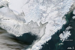
As the use of Alaska’s Arctic waters increases, so does the need for timely and detailed information about sea ice conditions. Using powerful software and historical databases extending back to the 1950s, AOOS is partnering with the Alaska Center for Climate Assessment and Policy (ACCAP) at the University of Alaska to produce a digital sea ice atlas for Alaska waters that will be publicly accessible through the AOOS website.
Who would use an ice atlas?
Changes in sea ice affect activities ranging from subsistence hunting and coastal travel to community safety and the use of ice as a platform by industry. There is a need for information about sea ice conditions at spatial-temporal resolutions higher than those from the National Weather Service. Alaska coastal communities from Dillingham to Nuiqsut, marine navigators, coastal managers, the US Army Corps of Engineers, the US Navy, and scientists—as well as those in the fishing, tourism, and offshore resource extraction industries—have expressed a need for an atlas that would provide such information.
Partners
- AOOS, ACCAP, the National Weather Service Sea Ice Desk, the National Snow and Ice Data Center, NOAA Pacific Environmental Marine Laboratory
Geographic extent
- Bering, Chukchi and Beaufort Seas, including Bering Strait, Norton Sound, Cook Inlet and other coastal inlets to a distance of ~300 nm (500 km) from shore
Atlas features
- Sea ice grids and accompanying digital maps of sea ice concentration
- Spatial resolution: ~20 km (finer where available)
- Temporal resolution: monthly mid-19th century–1952; weekly 1953–present
- Metadata about the archived data used to produce atlas
User defined maps, data, measurements and probabilities available for download
- Maps and data for user-specified time periods
- Maps and data as climatological averages for specific weeks/months of specified time periods
- Dates of ice loss and ice reappearance at prescribed locations
- Time series of ice coverage in coastal sectors
- Opening and closing dates for various shipping corridors
- Probabilistic depictions of ice coverage of various concentrations on specific dates
- User-defined seasonal severity indices
- Other measures to be determined through discussions with potential users
To learn more, contact the Alaska Sea Ice Atlas Project at the University of Alaska Fairbanks.

