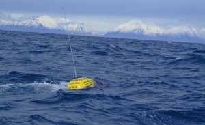
May 9th marked the successful launch of a new wave buoy off the coast of Anchor Point in Cook Inlet. The buoy transmits real-time information on wave height and direction, as well as sea surface temperature.
View the real-time data by visiting:
- AOOS data portal (enter the Real-time Sensor Map and zoom into Cook Inlet)
- Coastal Data Information Program (CDIP)
- National Data Buoy Center (NDBC)
Information from the buoy will be used to assist a wide array of marine operations. Cook Inlet receives high vessel traffic, as 95% of Alaska's goods arrive by barge through the inlet on the way to the Port of Anchorage. Additionally, an active sport fishing fleet departing from Homer and Anchor Point has desired a buoy for many years. Circulation patterns are complicated in the inlet, which also experiences high winds, seasonal sea ice, and tides up to 36 feet in places.
The buoy is a result of a collaborative partnership between multiple entities.
- AOOS will own and maintain the buoy.
- It is part of the national Coastal Data Information Program (CDIP) which is sponsored by the U.S. Army Corps of Engineers.
- The buoy was prepped at Scripps Oceanographic Institute in San Diego, and trucked to Homer.
- The chain was provided by NOAA’s National Data Buoy Center. and shipped to Alaska on a US Coast Guard cutter.
- Lake Clark National Park and Preserve provided their research vessel, the Chigmit, for deployment.
- The Kachemak Bay Research Reserve will be on call if the buoy separates from its line or has problems.

