
Click to enlarge
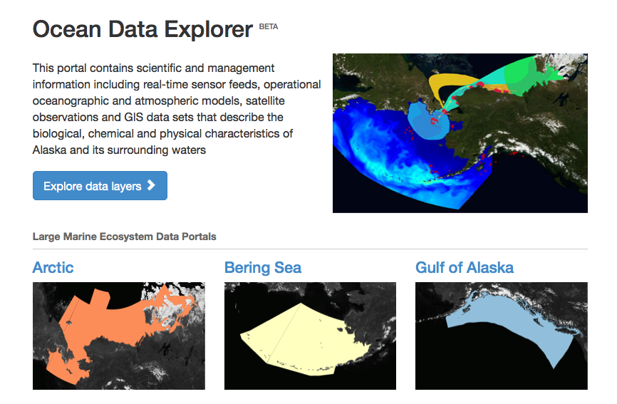
Access to marine and coastal data just got easier. This week, AOOS launched a new statewide portal called the Ocean Data Explorer. The Explorer covers the three large marine ecosystems (Arctic, Bering Sea, and Gulf of Alaska) so users can access every publicly accessible data set held by AOOS from this common entry point. Over 500 data sets are available from a broad spectrum of sources. (Think: shoretype characterization, habitat maps, wave forecasts, sampling locations, historic vessel traffic, real-time sensors, community socio-economics, and much more).
The Explorer can be found on the front of the AOOS homepage for easy entry.
New Features: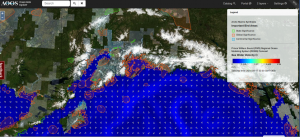

- Toggle easily between the data catalog and interactive map
- Units available in metric or standard
- Generate on-the-fly analytics of real-time and historic sensors
- Base map options include topo maps and NOAA charts
- iPad/tablet compatible
New Data Sets: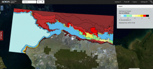

- Sea ice concentration and extent in high resolution from Shell
- Social & economic data for Arctic communities
- Historic data from real-time sensors including terrestrial
- And many, many more!
Coming Soon:
- Query available data by drawing a polygon
- Rearrange overlapping data layers in the legend
- Additional data (added weekly)
Help us Improve
We are interested how you are using the portal, and whether it meets your needs. If you have comments or suggestions please email dugan@aoos.org.