
Click to enlarge
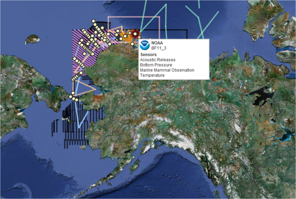
This screen shot of the Arctic Research Assets map shows station locations and monitoring transects. By scrolling over the map, the viewer can learn more about the specifics of each instrument or transect.
We’d like to add your instruments and monitoring sites
AOOS is currently in the process of updating and expanding the Research Assets Map. The map displays in-situ and transect research and monitoring in the Beaufort and Chukchi Seas.
Mapped locations help other researchers coordinate. Do you have instruments to add, or information on monitoring transects or other studies?
About the Map
Scientific research activity in Alaska’s Arctic has increased substantially in the last few years. AOOS has responded to a need for a visual inventory of the locations and types of oceanographic information being collected by creating a web-based, interactive map that allows users to display Arctic research information of interest. It is also a first step towards providing greater access to the variety of data collected by numerous parties, including industry.
The Research Asset Map was developed and is maintained by the AOOS Data Team. Thanks to NOAA, the University of Alaska, the University of Washington, the US Bureau of Ocean Energy Management, the National Science Foundation, Conoco Phillips, Shell Oil, and others for contributing information on their instruments.
Research Asset Map features
- User defined display: Show or hide specific types of assets (moorings, buoys, etc.) or combinations of assets within a user specified time frame
- Instant detail: Mouse over or select a particular asset to see project information such as asset owner, deployment and recovery dates, depth, location and contact information
Explore the Research Asset Map to display …
- In-place hardware such as acoustic recorders, buoys, ice profilers, meteorological stations, and moorings
- Transects for Autonomous Underwater Vehicles (AUVs), HF radar, planes, and ships
- Asset details such as instrument type, measurements, geospatial locations (lat/long), depth, operation start/end dates, owner and contact information, websites, and funding sources
Need assistance? Send us an email.