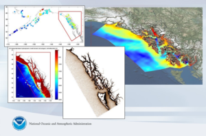
Southeast Alaska Model Release/Update
The VDatum 4.0.1 release on October 28, 2019 includes support for transformations involving the tidal datums of southeast Alaska (SE AK): local mean sea level (LMSL), mean lower low water (MLLW), mean high water (MHW), mean higher high water (MHHW), etc. The VDatum SE AK regional model extents are from just northwest of Yakutat Bay, south to the USA/Canada border within Dixon Entrance, below Dall Island. The 4.0.1 release fixes an issue with the previous release (4.0), where the topography of the sea surface (TSS = LMSL – geoid) grid values were not being applied correctly in the SE AK region. The SE AK coverage is the first region in VDatum to utilize a purely geopotential geoid for TSS. SE AK TSS grids reference the IGS08-based xGEOID rather than the NAD83-based NAVD88, and VDatum 4.0+ transformations between geometric (ellipsoidal), orthometric (geoidal), and tidal datums in SE AK are adjusted accordingly.
Comprehensive Alaska Model
The NOAA VDatum Program is working to release coverage for areas not currently supported, including all of Alaska, to enable marine geodesy through vertical transformation capabilities with associated uncertainty estimates. An exploratory hydrodynamic model is being developed by NOAA for comprehensive VDatum coverage of Alaska, leveraging previous work by Notre Dame. The current model consists of several million mesh elements and includes tidal datum points from 240 water level stations. Model runs will be used to resolve tidal datums and to help identify areas where improvements might be needed, including additional water level and datum observations with GPS/GNSS ties, and bathymetry and shoreline data. The graphics below were provided by Notre Dame and show the model’s nominal bathymetry and M2 tidal constituent amplitudes.


