
Click to enlarge
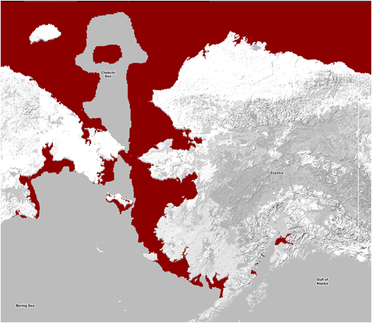
Sea ice extent produced by the National Ice Center and displayed by the AOOS Model Explorer
Using the AOOS Model Explorer, you can view the extent of sea ice in Alaska waters. The data comes from the National Ice Center (NIC), and the images are updated daily. The resolution is 4 km resolution.
These images are one of a variety of sea ice tools and products produced by the NIC, which provides measurements of daily sea ice extent and sea ice edge boundary for the Northern Hemisphere and 16 Arctic regions in a polar stereographic projection. The NIC utilizes visible imagery, passive microwave data, and NIC weekly analysis products to create the maps.
An archive of the previous four weeks of imagery can be obtained via FTP on the NIC website.
Using the Model Explorer:
- Click on the Model Explorer
- Find the “Layers” toolbar on the right, and hover your mouse over “Sea Ice”
- Click the “Sea Ice” link next to the globe icon
- Today's ice extent will load on the map