
Click to enlarge
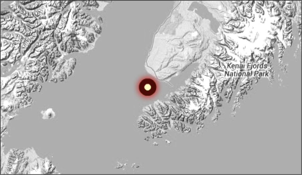
The buoy location has been modified slightly to avoid the strongest current while still providing critical data to Homer area boaters.
Real-time wave information for the Homer area has resumed. After breaking from its tether for the third time, the Lower Cook Inlet wave buoy (known as Bandit) is once again up and running. On July 20th, the ADFG research vessel Pandalus deployed the buoy during a research cruise under the Gulf Watch Alaska program, funded by the Exxon Valdez Oil Spill Trustee Council. The buoy streams information on wave height, direction, and wave period, as well as sea surface temperature. It is also equipped with a light that flashes five times in a 20-second cycle (five flashes 2 seconds apart, followed by a 12-second pause).
Boaters should note that the location of the buoy has moved slightly towards the mouth of Kachemak Bay. The shift was an effort to reduce tidal current and was guided by the help from the new Cook Inlet ocean circulation model, developed by Lyon Lanerolle and the team from the NOAA National Ocean Service Coast Survey Development Lab.
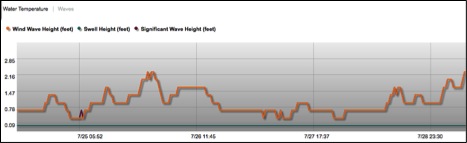
Data from the AOOS real-time sensor map shows wave height every half hour.

Data feeds for the buoy can be found here:
- AOOS Sensor Map (custom view)
- CDIP
- National Data Buoy Center
AOOS would like to extend gratitude to Kris Holderied (NOAA Kasitsna Bay Lab), Terry Thompson and Angie Doroff (Kachemak Bay Research Reserve), and the crew of the Pandalus. They volunteered significant time and energy to ensure this important resource is available to the community. If you cross paths, please tell them thanks.
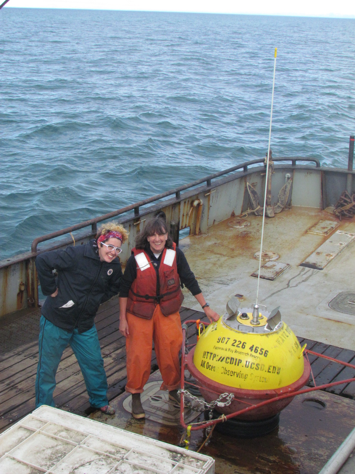
Starr Brainard and Kris Holderied of NOAA’s Kasitsna Bay Lab help launch the buoy while on a mission to collect oceanographic samples as part of the Gulf Watch Alaska program.
The boater community of Homer has shown tremendous support and appreciation for the buoy’s wave data. Many residents check the buoy’s real-time data on a daily basis, according to a user feedback survey circulated by AOOS last summer. According to charter captain Greg Sutter, “Real time weather and sea condition information allows all users and the angling public to be better informed, more comfortable and most importantly, safer when they venture beyond the shores”.
The buoy is a key component of the AOOS initiative to improve ocean monitoring in Cook Inlet to meet the needs of the inlet’s many users, including commercial and recreational fishermen, shipping, resource managers, and the oil and gas industry and oil spill responders. For more information on the buoy, you can email AOOS.
Previous articles on the buoy:
- Cook Inlet buoy rescued by Homer area residents and boating community – Jan 18, 2013
- Lower Cook Inlet Wave buoy up and running – Oct 1, 2012
- AOOS launches Cook Inlet Wave buoy survey – Aug 31, 2012
- Wave buoy comes loose – Aug 2, 2012
- Video of buoy deployment (2 minutes) – May 2012
- Wave buoy returns to Cook Inlet – May 3, 2012
- Cook Inlet Buoy takes a Swim – Oct 19, 2011