Modeler: Tal Ezer (Old Dominion Univ.) and Lie-Yauw Oey (Princeton Univ)
Funding Entity: Past support from BOEMRE and NOAA
- Input: Wind, seasonal
 temperature and salinity, river runoffs, entering tides from the GOA.
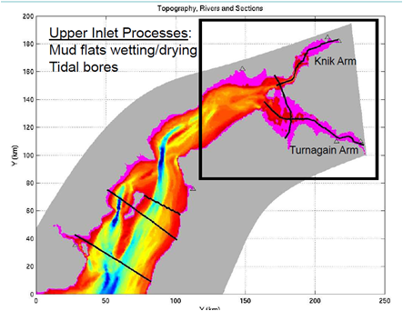
 - Scope: Entire Cook Inlet from Kodiak Island in the south to the end of the Knik and Turnagain Arms in the northeast.
- Resolution: About 300×100 km (curvilinear grid along CI)
- Timeline: Started in 2003, completed in 2009; continuation pending funding
Strengths: Simulate inundation as well as tidal bores and rip currents
Weaknesses: Lack of detailed topography of mudflats regions and other data at shallow regions.
Additional Data Needed: Better river runoffs, winds, and especially topography of mudflats. We are currently working on remote sensing data (Ezer and Liu, 2009) that will allow us to evaluate the model flood prediction and provide high resolution mapping of mudflats

