Historical Data
Oceanographic data has been collected in Cook Inlet since the 1970’s. AOOS is working to gather these datasets and make them accessible through the data portal. The list below includes type of data, year collected, collecting entity or researcher, geographic scope, and where they are currently available. We hope to make many of these downloadable over the next year with the expansion of our data portal. If you need to get in touch with any of the researchers about accessing their data in the meantime, please contact AOOS.
Cook Inlet Historical Data Set list
Bathymetric Data
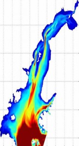
Many scientists and other stakeholders are interested in the bathymetry of Cook Inlet for circulation modeling, navigation, and other purposes. NOAA’s Office of Coast Survey has developed a Digital Elevation Model (DEM) for Cook Inlet as part of their larger scale circulation modeling project in the region.
Soon, bathymetry data will be accessible here:
- Raw Data
- DEM using NOAA grid
- Package with report, DVD with Matlab scripts, and raw data
Many thanks to Rich Patchen and Lyon Lanerolle for their work on these products.

